
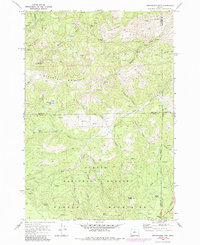
1968 Map of Stephenson Mtn
USGS Topo · Published 1972About this map
The Ochoco National Forest dominates this Central Oregon landscape, where the high-elevation terrain of the Ochoco Mountains and Stephenson Mountain meets a network of drainage gulches and creeks. At the time of this late 1960s survey, the area was characterized by its mining and ranching heritage, with sites like the Lucky Strike Mine and Valley View Mine appearing alongside the Old Stephenson Ranch. These remote locations were connected by a series of jeep trails and unimproved roads that traversed high points like Red Rock Pass and Ochoco Pass.
Find a feature on this map
36 named features on this map. Tap any name to fly to it.
Don’t see what you’re looking for? This feature index may not catch every label — zoom into the map to look around manually.
Map Details
Editions of this 1968 Stephenson Mtn Map
2 editions found
Other maps of this area

1926 · Mitchell
USGS Topo · 1:125,000

1948 · Ochoco Reservoir
USGS Topo · 1:62,500

1950 · Ochoco Reservoir
USGS Topo · 1:62,500

1951 · Lookout Mtn
USGS Topo · 1:62,500

1955 · Bend
USGS Topo · 1:250,000

1957 · Bend
USGS Topo · 1:250,000

1958 · Bend
USGS Topo · 1:250,000

1968 · Horse Heaven Creek
USGS Topo · 1:24,000

1968 · Painted Hills
USGS Topo · 1:24,000

1968 · Lawson Mtn
USGS Topo · 1:24,000