
1968 Map of Horse Heaven Creek
USGS Topo · Published 1971About this map
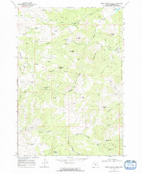
Horse Heaven Mine and its associated tailings sit on the eastern edge of this Jefferson County landscape, marking a site of industrial activity in an otherwise high-desert drainage system. The terrain is a complex network of steep canyons and high buttes, including Sugarloaf Butte, Kaser Butte, and Randle Butte. These formations are separated by deep-cut watercourses such as Muddy Creek and Amity Creek, which dominate the south and central portions of the survey.
Find a feature on this map
40 named features on this map. Tap any name to fly to it.
Don’t see what you’re looking for? This feature index may not catch every label — zoom into the map to look around manually.
Map Details
Editions of this 1968 Horse Heaven Creek Map
2 editions found
Other maps of this area

1926 · Mitchell
USGS Topo · 1:125,000

1955 · Bend
USGS Topo · 1:250,000

1957 · Bend
USGS Topo · 1:250,000

1958 · Bend
USGS Topo · 1:250,000

1966 · Antelope
USGS Topo · 1:62,500

1966 · Clarno
USGS Topo · 1:62,500

1968 · Axehandle Butte
USGS Topo · 1:24,000

1968 · Dutchman Creek
USGS Topo · 1:24,000

1968 · Stephenson Mtn
USGS Topo · 1:24,000
1968 · Sandrock Mtn
USGS Topo · 1:24,000