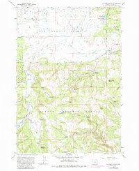
1965 Map of Williams Prairie
USGS Topo · Published 1985About this map
Big Summit Prairie dominates the northern half of this landscape, reflecting the unique high-altitude meadow systems within the Ochoko National Forest. Originally surveyed in 1965 with updates through the early 1980s, the map reveals a managed forest landscape defined by water storage and resource protection. Notable infrastructure includes the Cold Springs Guard Station and its adjacent Cold Springs Guard Sta Landing Field, essential for remote administrative access.
Find a feature on this map
51 named features on this map. Tap any name to fly to it.
Don’t see what you’re looking for? This feature index may not catch every label — zoom into the map to look around manually.
Map Details
Editions of this 1965 Williams Prairie Map
2 editions found
Other maps of this area

1951 · Post
USGS Topo · 1:62,500

1951 · Lookout Mtn
USGS Topo · 1:62,500

1955 · Bend
USGS Topo · 1:250,000

1957 · Bend
USGS Topo · 1:250,000

1958 · Bend
USGS Topo · 1:250,000

1965 · Williams Prairie
USGS Topo · 1:24,000

1966 · Keys Creek
USGS Topo · 1:24,000

1966 · Peterson Point
USGS Topo · 1:24,000

1966 · Mt. Pisgah
USGS Topo · 1:24,000

1981 · Prineville
USGS Topo · 1:100,000