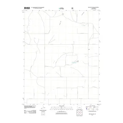
2011 Map of Pritchett NW
USGS Topo · Published 2011About this map
Graft sits at the intersection of a vast grid of section roads in this part of Baca County, serving as a primary landmark in a landscape defined by ranching and intermittent water sources. The map details the vital role of water management in this arid region, most notably at the Plum Creek Stock Reservoir and the accompanying Plum Creek Stock Dam. The terrain is characterized by a series of north-running drainages including Arrasmith Draw, Antelope Draw, and the winding paths of Plum Creek and Bear Creek. To the northwest, Antelope Springs provides a rare natural water point near Freezeout Creek. The sparse distribution of named points highlights the remote character of this high plains territory where the local economy is tied to the land and its limited resources.
Find a feature on this map
26 named features on this map. Tap any name to fly to it.
Don’t see what you’re looking for? This feature index may not catch every label — zoom into the map to look around manually.
Map Details
Editions of this 2011 Pritchett NW Map
This is the sole edition of this map. No revisions or reprints were ever made.
Other maps of this area

1891 · Higbee
USGS Topo · 1:125,000

1891 · Springfield
USGS Topo · 1:125,000

1892 · Two Butte
USGS Topo · 1:125,000

1892 · Mt Carrizo
USGS Topo · 1:125,000

1893 · Higbee
USGS Topo · 1:125,000

1893 · Two Butte
USGS Topo · 1:125,000

1893 · Springfield
USGS Topo · 1:125,000

1955 · La Junta
USGS Topo · 1:250,000

1958 · La Junta
USGS Topo · 1:250,000

1968 · La Junta
USGS Topo · 1:250,000