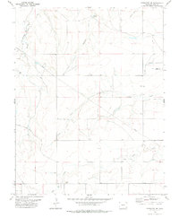
1978 Map of Pritchett NW
USGS Topo · Published 1978About this map
Antelope Springs sits at the head of Antelope Draw, marking a vital water source in this high plains landscape of southeastern Colorado. The map reveals a remote ranching and resource territory defined by intermittent watercourses like Plum Creek and Bear Creek. Infrastructure is sparse and utilitarian, centered on groundwater access and transportation as evidenced by the Graft Well, a localized Landing Strip, and a Pipeline cutting across the eastern sections. Land use is further illustrated by a Gravel Pit and scattered Wells, while fine red dashed lines throughout the quadrangle indicate the extensive network of fence lines required for cattle management. This 1978 edition records a landscape of wide-open spaces where survival and economy are tied directly to the drainage patterns of features like Freezout Creek and Arrasmith Draw.
Find a feature on this map
18 named features on this map. Tap any name to fly to it.
Don’t see what you’re looking for? This feature index may not catch every label — zoom into the map to look around manually.
Map Details
Editions of this 1978 Pritchett NW Map
This is the sole edition of this map. No revisions or reprints were ever made.
Other maps of this area

1891 · Higbee
USGS Topo · 1:125,000

1891 · Springfield
USGS Topo · 1:125,000

1892 · Two Butte
USGS Topo · 1:125,000

1892 · Mt Carrizo
USGS Topo · 1:125,000

1893 · Higbee
USGS Topo · 1:125,000

1893 · Two Butte
USGS Topo · 1:125,000

1893 · Springfield
USGS Topo · 1:125,000

1955 · La Junta
USGS Topo · 1:250,000

1958 · La Junta
USGS Topo · 1:250,000

1968 · La Junta
USGS Topo · 1:250,000