2022 Map of Proctor
USGS Topo · Published 2022About this map
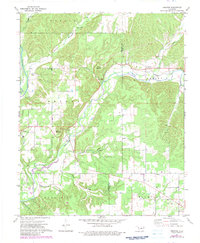
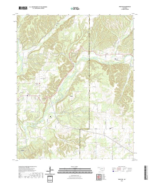
The Baron Fork cuts a winding path through the Ozark foothills of Adair and Cherokee counties, serving as a central geographical feature for the small communities of Eldon and Welling. This modern survey reveals a landscape where family history is deeply rooted in the terrain, evidenced by numerous burial sites like the Cobb Family Cem and the Proctor - Sanders Community Cem. The topography is defined by significant rises such as Proctor Mtn and Eldon Mtn, which overlook a network of creek-fed hollows including Pumpkin Hollow and Field Hollow. The settlement pattern remains largely rural, with dwellings concentrated along the Illinois River and historical corridors like McLemore Hollow Rd. Researchers will find a preserved record of local genealogy through the many named cemeteries, while the placement of Wall Trip Br and Willow Br Cr illustrates the hydrological drainage system of this portion of eastern Oklahoma.
Find a feature on this map
84 named features on this map. Tap any name to fly to it.
Don’t see what you’re looking for? This feature index may not catch every label — zoom into the map to look around manually.
Map Details
Editions of this 2022 Proctor Map
This is the sole edition of this map. No revisions or reprints were ever made.