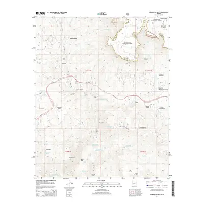
2014 Map of Promontory Butte
USGS Topo · Published 2014About this map
Christopher Creek and the surrounding high-country settlements define this portion of the Mogollon Rim, where the landscape drops sharply from the Mogollon Plateau into the dramatic drainages of the Tonto National Forest. This 2014 survey documents a complex network of water resources essential to the region's ranching and residential history, from Horton Spring in the north to the Bear Flat Trail Tank in the south. The transition from the high rim at Promontory Butte down to the valley floors is marked by numerous draws and canyons, including Thompson Draw and Bearhide Canyon. The presence of Schoolhouse Tank and established ranching sites like Hunter Creek Ranch reflects the enduring human footprint in a region defined by its vertical relief. State Hwy 260 serves as the primary artery connecting these isolated communities, winding past Little Green Valley and Kohls Ranch.
Find a feature on this map
73 named features on this map. Tap any name to fly to it.
Don’t see what you’re looking for? This feature index may not catch every label — zoom into the map to look around manually.
Map Details
Editions of this 2014 Promontory Butte Map
This is the sole edition of this map. No revisions or reprints were ever made.
Other maps of this area

1886 · Holbrook
USGS Topo · 1:250,000

1887 · Verde
USGS Topo · 1:250,000

1892 · Verde
USGS Topo · 1:250,000

1893 · Holbrook
USGS Topo · 1:250,000

1934 · Promontory Butte
USGS Topo · 1:62,500

1937 · Diamond Butte
USGS Topo · 1:48,000

1939 · Promontory Butte
USGS Topo · 1:62,500

1943 · Diamond Butte
USGS Topo · 1:62,500

1952 · Promontory Butte
USGS Topo · 1:62,500

1954 · Holbrook
USGS Topo · 1:250,000
Featured Places
- Christopher Creek, AZ
- Thompson Draw Summer Homes Unit #1, AZ
- Bear Flat, AZ
- Hunter Creek, AZ
- Christopher Creek, AZ