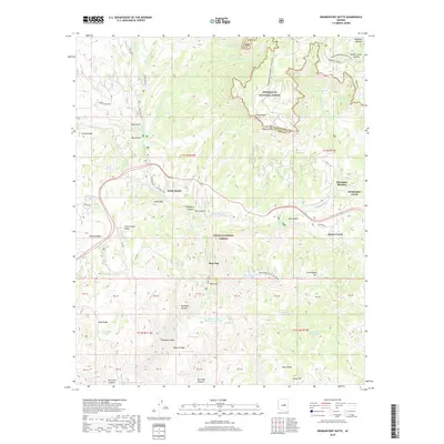
2018 Map of Promontory Butte
USGS Topo · Published 2018About this map
Kohls Ranch and the small mountain settlements of Bear Flat and Christopher Creek anchor this study of the Gila County high country. The landscape is dominated by the dramatic elevation change of the Mogollon Rim, which separates the Mogollon Plateau to the north from the canyon-riven lands of the Tonto National Forest below. Transportation history is etched into the terrain via the General Crook trail and the Zane Grey Hwy, reflecting the era's transition from historic pack trails to modern scenic corridors. Water management in this arid environment is evident through the numerous named stock tanks and springs, such as Horton Spring and Mescal Ridge Tank Number Two. The map also captures the seasonal recreational character of the region, specifically noted by the Promontory Snowmobile Loop winding near Promontory Butte.
Find a feature on this map
81 named features on this map. Tap any name to fly to it.
Don’t see what you’re looking for? This feature index may not catch every label — zoom into the map to look around manually.
Map Details
Editions of this 2018 Promontory Butte Map
This is the sole edition of this map. No revisions or reprints were ever made.
Other maps of this area

1886 · Holbrook
USGS Topo · 1:250,000

1887 · Verde
USGS Topo · 1:250,000

1892 · Verde
USGS Topo · 1:250,000

1893 · Holbrook
USGS Topo · 1:250,000

1934 · Promontory Butte
USGS Topo · 1:62,500

1937 · Diamond Butte
USGS Topo · 1:48,000

1939 · Promontory Butte
USGS Topo · 1:62,500

1943 · Diamond Butte
USGS Topo · 1:62,500

1952 · Promontory Butte
USGS Topo · 1:62,500

1954 · Holbrook
USGS Topo · 1:250,000
Featured Places
- Christopher Creek, AZ
- Thompson Draw Summer Homes Unit #1, AZ
- Bear Flat, AZ
- Hunter Creek, AZ
- Christopher Creek, AZ