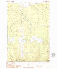
1989 Map of Prospect Hill
USGS Topo · Published 1989About this map
Chartierville and the surrounding borderlands of the Montagnes Blanches define this landscape along the international boundary between New Hampshire and Quebec. The 1980s terrain is marked by a complex network of waterways, including Riviere Ditton and its branches, which drain the high elevations of Prospect Hill and Montagne des Lignes. This survey provides a distinct look at the northernmost reaches of Pittsburg in Coos County, where the Connecticut Lakes State Forest meets the Canadian line. Settlement patterns reflect the cross-border culture of the region, featuring locations like Petit-Canada and Petite-Angleterre. Local infrastructure such as a small Cem and several Gravel Pits are visible, alongside the drainage of Ruisseau Mining, suggesting the primary land uses of forestry and resource extraction in this remote international corridor.
Find a feature on this map
25 named features on this map. Tap any name to fly to it.
Don’t see what you’re looking for? This feature index may not catch every label — zoom into the map to look around manually.
Map Details
Editions of this 1989 Prospect Hill Map
This is the sole edition of this map. No revisions or reprints were ever made.
Other maps of this area

1925 · Indian Stream
USGS Topo · 1:48,000

1926 · Indian Stream
USGS Topo · 1:62,500

1927 · Indian Stream
USGS Topo · 1:62,500

1927 · Moose Bog
USGS Topo · 1:48,000

1927 · Second Lake
USGS Topo · 1:62,500

1931 · Moose Bog
USGS Topo · 1:62,500

1932 · Second Lake
USGS Topo · 1:62,500

1949 · Jackman
USGS Topo · 1:250,000

1963 · Jackman
USGS Topo · 1:250,000

1966 · Sherbrooke
USGS Topo · 1:250,000