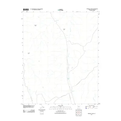
2011 Map of Prospect Point
USGS Topo · Published 2011About this map
Laguna Valley dominates this high-desert landscape in Coconino County, characterized by a sparse but essential network of water collection points. In an environment where surface water is seasonal, the presence of numerous named catchments like Turkey Tank, Natural Tank, and Thompson Tank illustrates the historical reliance on these features for livestock and travel across the plateau. The terrain is defined by prominent elevations such as Prospect Point and Prospect Ridge, which offer vantage points over the drainage systems of Mohawk Creek and Albers Wash. Transportation in this modern era relies on established routes such as B I A Hwy 11 and Indian Service Road 13, which connect the remote drainage basins and grazing lands. The map provides a clear record of these isolated landmarks and the infrastructure required to navigate the arid northern Arizona territory.
Find a feature on this map
19 named features on this map. Tap any name to fly to it.
Don’t see what you’re looking for? This feature index may not catch every label — zoom into the map to look around manually.
Map Details
Editions of this 2011 Prospect Point Map
This is the sole edition of this map. No revisions or reprints were ever made.
Other maps of this area

1886 · Diamond Creek
USGS Topo · 1:250,000

1886 · Mt. Trumbull
USGS Topo · 1:250,000

1886 · Chino
USGS Topo · 1:250,000

1886 · Kaibab
USGS Topo · 1:250,000

1891 · Chino
USGS Topo · 1:250,000

1892 · Diamond Creek
USGS Topo · 1:250,000

1892 · Mt. Trumbull
USGS Topo · 1:250,000

1948 · Williams
USGS Topo · 1:250,000

1953 · Grand Canyon
USGS Topo · 1:250,000

1954 · Williams
USGS Topo · 1:250,000