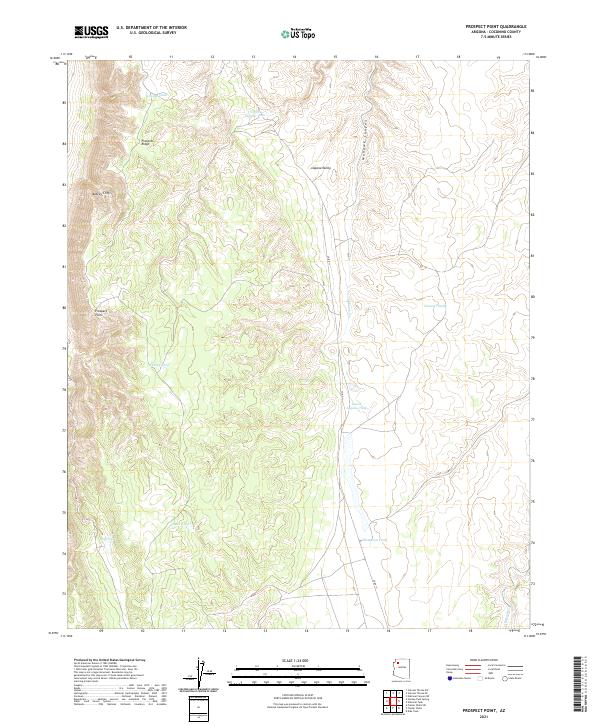
2021 Map of Prospect Point
USGS Topo · Published 2021About this map
Prospect Point and the towering Aubrey Cliffs dominate this high-desert landscape in Coconino County. The terrain is defined by dramatic verticality, where Prospect Ridge overlooks the deep incision of Mohawk Canyon. Settlement is sparse in this arid environment, evidenced by the prevalence of named water catchments rather than towns. These vital features, including Copper Tank, Turkey Tank, and Natural Tank, reflect the primary infrastructure of the range. The north-south corridor of Co RD 11 provides the only significant transit route, following the floor of Laguna Valley alongside Mohawk Cr. This topography, characterized by limestone rims and seasonal drainages like Albers Wash, indicates a landscape managed for cattle and conservation rather than urban development.
Find a feature on this map
20 named features on this map. Tap any name to fly to it.
Don’t see what you’re looking for? This feature index may not catch every label — zoom into the map to look around manually.
Map Details
Editions of this 2021 Prospect Point Map
This is the sole edition of this map. No revisions or reprints were ever made.
Other maps of this area

1886 · Diamond Creek
USGS Topo · 1:250,000

1886 · Mt. Trumbull
USGS Topo · 1:250,000

1886 · Chino
USGS Topo · 1:250,000

1886 · Kaibab
USGS Topo · 1:250,000

1891 · Chino
USGS Topo · 1:250,000

1892 · Diamond Creek
USGS Topo · 1:250,000

1892 · Mt. Trumbull
USGS Topo · 1:250,000

1948 · Williams
USGS Topo · 1:250,000

1953 · Grand Canyon
USGS Topo · 1:250,000

1954 · Williams
USGS Topo · 1:250,000