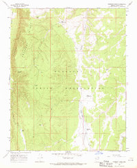
1967 Map of Prospect Point
USGS Topo · Published 1970About this map
The Hualapai Indian Reservation defines the central and southern reaches of this landscape, where the high desert terrain is punctuated by a series of vital water catchments known locally as tanks. These features, such as Natural Tank, Thompson Tank, and Bear Tank, indicate the critical importance of water management in a region defined by dramatic verticality. To the west, the massive Aubrey Cliffs drop away from Prospect Ridge into the wide expanse of Prospect Valley, while the eastern portion of the map is dominated by the winding path of Mohawk Canyon.
Find a feature on this map
18 named features on this map. Tap any name to fly to it.
Don’t see what you’re looking for? This feature index may not catch every label — zoom into the map to look around manually.
Map Details
Editions of this 1967 Prospect Point Map
This is the sole edition of this map. No revisions or reprints were ever made.
Other maps of this area

1886 · Diamond Creek
USGS Topo · 1:250,000

1886 · Mt. Trumbull
USGS Topo · 1:250,000

1886 · Chino
USGS Topo · 1:250,000

1886 · Kaibab
USGS Topo · 1:250,000

1891 · Chino
USGS Topo · 1:250,000

1892 · Diamond Creek
USGS Topo · 1:250,000

1892 · Mt. Trumbull
USGS Topo · 1:250,000

1948 · Williams
USGS Topo · 1:250,000

1953 · Grand Canyon
USGS Topo · 1:250,000

1954 · Williams
USGS Topo · 1:250,000