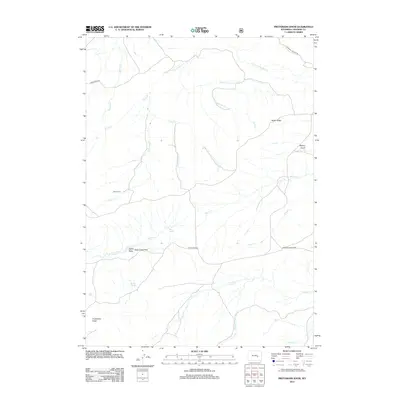
2012 Map of Protsmans Knob
USGS Topo · Published 2012About this map
Protsmans Knob rises above a high-desert landscape defined by a complex drainage network in this section of Converse County. The area’s ranching and homesteading heritage is evidenced by the presence of Miller Cabin near the banks of Little Deer Cr, while reliable water sources like Mesa Spring and Alphin Spring provided essential resources for life in this arid environment. Significant terrain features such as Rocky Ridge and Mickey Gulch overlook the lower Duck Creek Flats, where seasonal waterways including Virden Cr and Strawberry Cr converge. This 2012 survey illustrates a remote landscape where travel still follows traditional paths like Mormon Canyon Rd and Duck Creek Rd, highlighting the enduring spatial relationship between natural landmarks and the few human improvements established in the region.
Find a feature on this map
27 named features on this map. Tap any name to fly to it.
Don’t see what you’re looking for? This feature index may not catch every label — zoom into the map to look around manually.
Map Details
Editions of this 2012 Protsmans Knob Map
This is the sole edition of this map. No revisions or reprints were ever made.
Other maps of this area

1949 · Parkerton
USGS Topo · 1:24,000

1949 · Glenrock
USGS Topo · 1:24,000

1950 · Lockett
USGS Topo · 1:24,000

1950 · Parkerton
USGS Topo · 1:24,000

1950 · Glenrock
USGS Topo · 1:24,000

1954 · Torrington
USGS Topo · 1:250,000

1955 · Casper
USGS Topo · 1:250,000

1958 · Casper
USGS Topo · 1:250,000

1958 · Torrington
USGS Topo · 1:250,000

1960 · Banner Mtn
USGS Topo · 1:24,000