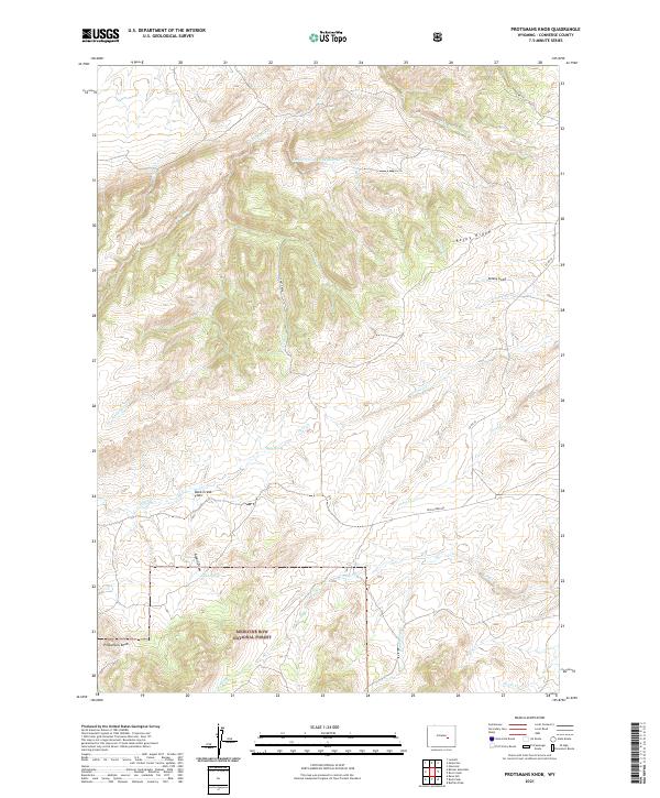
2021 Map of Protsmans Knob
USGS Topo · Published 2021About this map
Medicine Bow National Forest lands dominate the southern portion of this Converse County quadrangle, where the terrain transitions into the high drainage basins of the Laramie Range. The landscape is defined by a complex network of seasonal and perennial waterways including Little Deer Cr, Virden Cr, and Strawberry Cr, which carve through the high-elevation plateaus. The namesake Protsmans Knob stands as a prominent topographical landmark in the southwest, while Rocky Ridge and Mickey Gulch anchor the northeastern sector. Human activity is focused primarily along sparse corridors like Duck Creek Rd and Co RD 18, providing access to remote locations such as Mesa Spring and the open expanses of Duck Creek Flats. This modern survey reflects the enduring character of the Wyoming high country, where named draws and springs serve as critical markers for navigation and land management.
Find a feature on this map
30 named features on this map. Tap any name to fly to it.
Don’t see what you’re looking for? This feature index may not catch every label — zoom into the map to look around manually.
Map Details
Editions of this 2021 Protsmans Knob Map
This is the sole edition of this map. No revisions or reprints were ever made.
Other maps of this area

1949 · Parkerton
USGS Topo · 1:24,000

1949 · Glenrock
USGS Topo · 1:24,000

1950 · Lockett
USGS Topo · 1:24,000

1950 · Parkerton
USGS Topo · 1:24,000

1950 · Glenrock
USGS Topo · 1:24,000

1954 · Torrington
USGS Topo · 1:250,000

1955 · Casper
USGS Topo · 1:250,000

1958 · Casper
USGS Topo · 1:250,000

1958 · Torrington
USGS Topo · 1:250,000

1960 · Banner Mtn
USGS Topo · 1:24,000