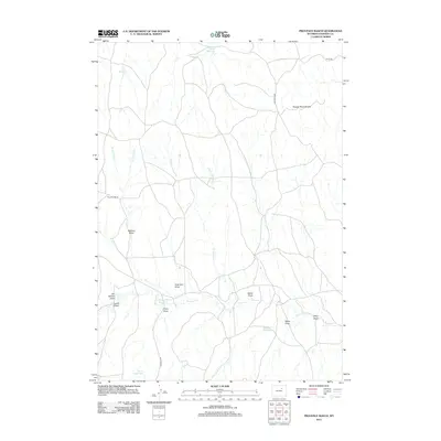
2012 Map of Provence Ranch
USGS Topo · Published 2012About this map
Provence Ranch serves as the namesake landmark for this segment of Johnson County, a landscape defined by an extensive network of ephemeral drainages and cattle-ranching infrastructure. The map traces the historical path of the Bozeman Trl, which cuts across the southwestern corner of the terrain, providing a direct link to the region's 19th-century migration and frontier history. The topography is shaped by the Powder River Breaks in the northeast, while the rest of the quadrangle is punctuated by dozens of draws and reservoirs. Named features like Hague Paxton Reservoir, Joe Reservoir, and Tryon Reservoir indicate the vital role of water management in this arid environment. The naming of various draws, such as Adamson Draw, Sattler Draw, and Ethyl Draw, reflects the local genealogy and land use patterns of the ranching families who established themselves along the tributaries of Ninemile Cr and Antelope Cr.
Find a feature on this map
25 named features on this map. Tap any name to fly to it.
Don’t see what you’re looking for? This feature index may not catch every label — zoom into the map to look around manually.
Map Details
Editions of this 2012 Provence Ranch Map
This is the sole edition of this map. No revisions or reprints were ever made.
Other maps of this area

1953 · Hoe Ranch
USGS Topo · 1:24,000

1953 · Fort Reno
USGS Topo · 1:24,000

1955 · Sheridan
USGS Topo · 1:250,000

1955 · Arminto
USGS Topo · 1:250,000

1958 · Sheridan
USGS Topo · 1:250,000

1958 · Arminto
USGS Topo · 1:250,000

1961 · Soldier Creek
USGS Topo · 1:24,000

1961 · Fourmile Reservoir
USGS Topo · 1:24,000

1961 · Provence Ranch
USGS Topo · 1:24,000

1961 · Elaine Draw
USGS Topo · 1:24,000