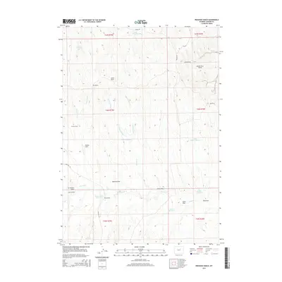
2015 Map of Provence Ranch
USGS Topo · Published 2015About this map
Provence Ranch sits at the heart of this high plains landscape in Johnson County, defined by a complex network of ephemeral drainages and modern water management. The terrain is deeply incised by family-named features such as Neilson Draw, Adamson Draw, and Art Ekland Draw, which feed into larger water systems like Ninemile Cr and Antelope Cr. This 2015 survey illustrates the vital role of artificial reservoirs in this arid environment, with numerous basins like Joe Reservoir, Margaret Reservoir, and the Ethyl Number 1 Reservoir strategically placed across the cattle-ranching country. The eastern edge of the map gives way to the Powder River Breaks, a distinct topographical shift where the tablelands begin to drop toward the Powder River basin. Local transit is confined to few improved routes including Irigaray Rd and Nine Mile Rd.
Find a feature on this map
37 named features on this map. Tap any name to fly to it.
Don’t see what you’re looking for? This feature index may not catch every label — zoom into the map to look around manually.
Map Details
Editions of this 2015 Provence Ranch Map
This is the sole edition of this map. No revisions or reprints were ever made.
Other maps of this area

1953 · Hoe Ranch
USGS Topo · 1:24,000

1953 · Fort Reno
USGS Topo · 1:24,000

1955 · Sheridan
USGS Topo · 1:250,000

1955 · Arminto
USGS Topo · 1:250,000

1958 · Sheridan
USGS Topo · 1:250,000

1958 · Arminto
USGS Topo · 1:250,000

1961 · Soldier Creek
USGS Topo · 1:24,000

1961 · Fourmile Reservoir
USGS Topo · 1:24,000

1961 · Provence Ranch
USGS Topo · 1:24,000

1961 · Elaine Draw
USGS Topo · 1:24,000