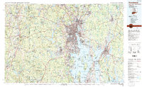
1984 Map of Providence
USGS Topo · Published 1985About this map
Providence and the surrounding urban corridors of Cranston, Warwick, and Pawtucket dominate this 1980s-era topographic survey, illustrating the dense industrial and maritime character of the Rhode Island coast. The sheet details the complex geography of Narragansett Bay, from the major port facilities at Fall River and Newport to the strategic positioning of Quonset Point Naval Air Station and Camp Fogarty Nat Guard. Inland, the massive Scituate Reservoir stands out as a critical landscape feature, providing a stark contrast to the web of major transit lines including the Amtrak and Conrail corridors.
Find a feature on this map
384 named features on this map. Tap any name to fly to it.
Don’t see what you’re looking for? This feature index may not catch every label — zoom into the map to look around manually.
Map Details
Editions of this 1984 Providence Map
This is the sole edition of this map. No revisions or reprints were ever made.
Other maps of this area

1885 · New Bedford
USGS Topo · 1:62,500

1885 · Abington
USGS Topo · 1:62,500

1885 · Sakonnet
USGS Topo · 1:62,500

1885 · Middleboro
USGS Topo · 1:62,500

1885 · Taunton
USGS Topo · 1:62,500

1886 · Blackstone
USGS Topo · 1:62,500

1886 · Dedham
USGS Topo · 1:62,500

1887 · Brookfield
USGS Topo · 1:62,500

1887 · Franklin
USGS Topo · 1:62,500

1887 · Providence
USGS Topo · 1:62,500