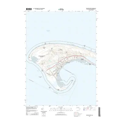
2015 Map of Provincetown
USGS Topo · Published 2015About this map
Provincetown occupies the hooked tip of the Cape, defined by a complex landscape of shifting sands and protected coastal ecology within the Cape Cod National Seashore. The settlement pattern follows the curve of Provincetown Harbor, where dense street networks like Commercial St and Bradford St contrast with the expansive Dunes of the Provincelands to the north. This 2015 survey illustrates how the town remains anchored by its geography, with significant high points such as Telegraph Hill and Mt Gilboa rising above the surrounding coastal plain.
Find a feature on this map
58 named features on this map. Tap any name to fly to it.
Don’t see what you’re looking for? This feature index may not catch every label — zoom into the map to look around manually.
Map Details
Editions of this 2015 Provincetown Map
This is the sole edition of this map. No revisions or reprints were ever made.
Other maps of this area

1887 · Wellfleet
USGS Topo · 1:62,500

1887 · Provincetown
USGS Topo · 1:62,500

1889 · Provincetown
USGS Topo · 1:62,500

1889 · Wellfleet
USGS Topo · 1:62,500

1893 · Wellfleet
USGS Topo · 1:62,500

1898 · Provincetown
USGS Topo · 1:62,500

1942 · Cape Cod Bay
USGS Topo · 1:125,000

1944 · Provincetown
USGS Topo · 1:31,680
1944 · North Truro
USGS Topo · 1:31,680

1947 · Providence
USGS Topo · 1:250,000