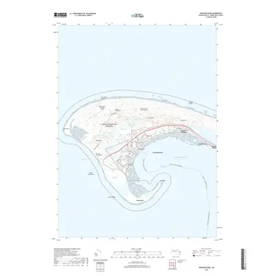
2018 Map of Provincetown
USGS Topo · Published 2018About this map
Provincetown occupies the narrow, hooked tip of the Cape, where a dense network of residential streets like Commercial St and Alden St gives way to the protected expanses of the Cape Cod National Seashore. This modern topographical survey illustrates the distinct boundary between the historic harbor settlement and the shifting environment of the Dunes of the Provincelands. Elevated points such as High Pole Hill, Town Hill, and Telegraph Hill dominate the local topography, while numerous freshwater bodies like Shank Painter Pond and Pasture Pond are scattered among the interior dunes. The map also traces the vital transit lines that connect this maritime community to the mainland, including the Provincetown Municipal Airport and the seasonal route of the Plymouth - Provincetown Ferry across Provincetown Harbor. Local history is anchored by sites like Saint Peters Cem and the sprawling Long Point Marshes that wrap around the lower harbor.
Find a feature on this map
50 named features on this map. Tap any name to fly to it.
Don’t see what you’re looking for? This feature index may not catch every label — zoom into the map to look around manually.
Map Details
Editions of this 2018 Provincetown Map
This is the sole edition of this map. No revisions or reprints were ever made.
Other maps of this area

1887 · Wellfleet
USGS Topo · 1:62,500

1887 · Provincetown
USGS Topo · 1:62,500

1889 · Provincetown
USGS Topo · 1:62,500

1889 · Wellfleet
USGS Topo · 1:62,500

1893 · Wellfleet
USGS Topo · 1:62,500

1898 · Provincetown
USGS Topo · 1:62,500

1942 · Cape Cod Bay
USGS Topo · 1:125,000

1944 · Provincetown
USGS Topo · 1:31,680
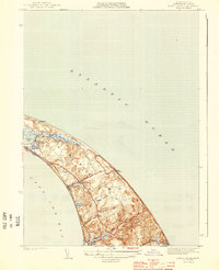
1944 · North Truro
USGS Topo · 1:31,680

1947 · Providence
USGS Topo · 1:250,000