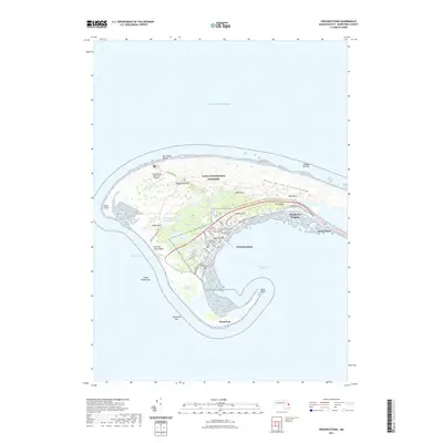
2021 Map of Provincetown
USGS Topo · Published 2021About this map
The Cape Cod National Seashore dominates this portion of the peninsula, preserving a shifting landscape of dunes and freshwater ponds. The dense cluster of Provincetown sits at the southern hook, where the street grid is defined by the long curves of Commercial St and Bradford St. This settlement pattern reflects a historic reliance on the sheltered Provincetown Harbor and the surrounding maritime environment. Local history is deeply rooted in the high ground of Town Hill and High Pole Hill, while several burying grounds including Saint Peters Cem and Hamilton Cem sit near the center of town.
Find a feature on this map
52 named features on this map. Tap any name to fly to it.
Don’t see what you’re looking for? This feature index may not catch every label — zoom into the map to look around manually.
Map Details
Editions of this 2021 Provincetown Map
This is the sole edition of this map. No revisions or reprints were ever made.
Other maps of this area

1887 · Wellfleet
USGS Topo · 1:62,500

1887 · Provincetown
USGS Topo · 1:62,500

1889 · Provincetown
USGS Topo · 1:62,500

1889 · Wellfleet
USGS Topo · 1:62,500

1893 · Wellfleet
USGS Topo · 1:62,500

1898 · Provincetown
USGS Topo · 1:62,500

1942 · Cape Cod Bay
USGS Topo · 1:125,000

1944 · Provincetown
USGS Topo · 1:31,680
1944 · North Truro
USGS Topo · 1:31,680

1947 · Providence
USGS Topo · 1:250,000