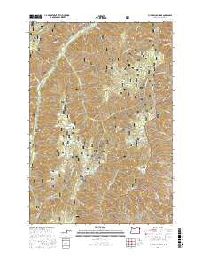
2017 Map of Puderbaugh Ridge
USGS Topo · Published 2017About this map
The Imnaha River winds through the deep canyons and high divides of Wallowa County, defining the drainage patterns for this section of the Wallowa National Forest. The presence of the Lookingglass Fish Hatchery along the riverbanks highlights the area's role in local fishery management and conservation. High points like Puderbaugh Ridge and Summit Ridge offer significant topographical relief, connected by a network of forest service roads such as the Wallowa Mountain Loop and Upper Imnaha Rd. This survey documents a landscape dominated by name-bearing drainages like Crazyman Cr and McGraw Cr, as well as specific high-elevation landmarks like the P O Saddle and Keener Gulch. The boundary between the Wallowa and Whitman National Forest crosses the southern portion of the sheet, where McGraw Spring provides a permanent water source in the high country.
Find a feature on this map
35 named features on this map. Tap any name to fly to it.
Don’t see what you’re looking for? This feature index may not catch every label — zoom into the map to look around manually.
Map Details
Editions of this 2017 Puderbaugh Ridge Map
This is the sole edition of this map. No revisions or reprints were ever made.
Other maps of this area

1920 · Seven Devils Mining District
USGS Topo · 1:48,000

1922 · He Devil
USGS Topo · 1:48,000

1954 · Harl Butte
USGS Topo · 1:62,500

1955 · Grangeville
USGS Topo · 1:250,000

1957 · He Devil
USGS Topo · 1:62,500

1957 · Cuprum
USGS Topo · 1:62,500

1957 · Homestead
USGS Topo · 1:62,500

1959 · Grangeville
USGS Topo · 1:250,000

1987 · Riggins
USGS Topo · 1:100,000
1990 · Puderbaugh Ridge
USGS Topo · 1:24,000