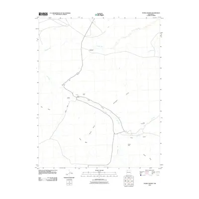
2010 Map of Pueblo Bonito
USGS Topo · Published 2010About this map
Pueblo Bonito and Chettro Kettle serve as the architectural centerpieces of this high-desert landscape in the Eastern Navajo Agency. The map reveals a complex network of seasonal drainages, including the broad Chaco Wash and its many tributaries like Gallo Wash and Fajada Wash, which have carved deep corridors through the sandstone. The terrain is defined by dramatic elevations such as Fajada Butte and the expansive Chacra Mesa, illustrating the environmental constraints that shaped both ancient and modern human activity. Traces of historical trade and habitation appear at the Chaco Canyon Trading Post and named points like Putnam, while the modern park presence is noted at Gallo Campground. The relationship between the flat canyon floors and the sheltering walls of Mockingbird Canyon and Clys Canyon highlights the area's unique topography.
Find a feature on this map
21 named features on this map. Tap any name to fly to it.
Don’t see what you’re looking for? This feature index may not catch every label — zoom into the map to look around manually.
Map Details
Editions of this 2010 Pueblo Bonito Map
This is the sole edition of this map. No revisions or reprints were ever made.
Other maps of this area

1883 · Mt. Taylor
USGS Topo · 1:250,000

1886 · Wingate
USGS Topo · 1:250,000

1886 · Mt. Taylor
USGS Topo · 1:250,000

1889 · Largo
USGS Topo · 1:250,000

1889 · Chaco
USGS Topo · 1:250,000

1892 · Wingate
USGS Topo · 1:250,000

1892 · Chaco
USGS Topo · 1:250,000

1892 · Mt. Taylor
USGS Topo · 1:250,000

1895 · Largo
USGS Topo · 1:250,000

1899 · Mt. Taylor
USGS Topo · 1:250,000