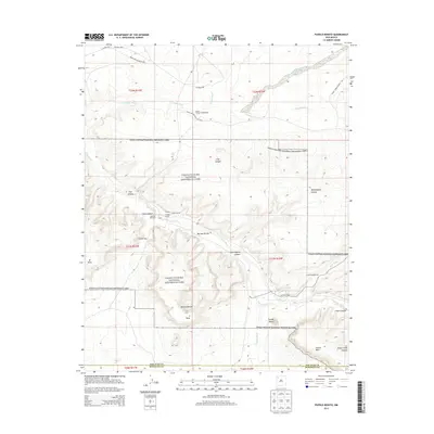
2013 Map of Pueblo Bonito
USGS Topo · Published 2013About this map
Pueblo Bonito and Chetro Kettle sit at the heart of this survey of the San Juan and McKinley county borderlands. The landscape is defined by the canyon-and-mesa topography of the Chaco Culture National Historical Park, where the Chaco Wash and its tributaries like Escavada Wash have carved deep drainages. The map captures archaeological sites and local landmarks including Heshoda Bitsulliya and Putnam, alongside the Chaco Canyon Trading Post. Significant vertical relief is mapped through named features like Fajada Butte and the extensive Chacra Mesa. Transport and access are limited to remote routes such as Indian Service Route 45E and CO Road 7950, reflecting the protected and isolated nature of these ancestral lands in the high desert of the Eastern Navajo Agency.
Find a feature on this map
35 named features on this map. Tap any name to fly to it.
Don’t see what you’re looking for? This feature index may not catch every label — zoom into the map to look around manually.
Map Details
Editions of this 2013 Pueblo Bonito Map
This is the sole edition of this map. No revisions or reprints were ever made.
Other maps of this area

1883 · Mt. Taylor
USGS Topo · 1:250,000

1886 · Wingate
USGS Topo · 1:250,000

1886 · Mt. Taylor
USGS Topo · 1:250,000

1889 · Largo
USGS Topo · 1:250,000

1889 · Chaco
USGS Topo · 1:250,000

1892 · Wingate
USGS Topo · 1:250,000

1892 · Chaco
USGS Topo · 1:250,000

1892 · Mt. Taylor
USGS Topo · 1:250,000

1895 · Largo
USGS Topo · 1:250,000

1899 · Mt. Taylor
USGS Topo · 1:250,000