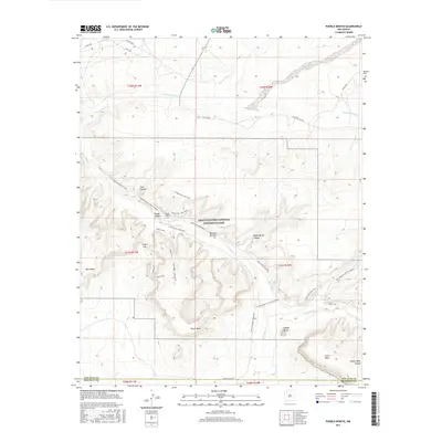
2017 Map of Pueblo Bonito
USGS Topo · Published 2017About this map
Chaco Culture National Historical Park preserves a dense network of ancestral sites and intricate terrain in this high desert landscape. The map centers on the iconic Pueblo Bonito ruins, positioned near the junction of Chaco Wash and the surrounding canyon walls. To the south, the prominent Fajada Butte stands as a distinct landmark above the desert floor, while the expansive elevations of South Mesa and Chacra Mesa define the local topography. This modern survey details an extensive system of access routes and interpretive paths, including the Penasco Blanco Trail, Wijiji Trail, and the Pueblo Alto Loop Trail. The drainage patterns of Escavada Wash and Kimbeto Wash illustrate the hydrological forces that shaped Clys Canyon and Mockingbird Canyon. This detailed view of the Eastern Navajo Agency territory shows the spatial relationship between the canyon floor's historical structures and the high mesas that overlook them.
Find a feature on this map
40 named features on this map. Tap any name to fly to it.
Don’t see what you’re looking for? This feature index may not catch every label — zoom into the map to look around manually.
Map Details
Editions of this 2017 Pueblo Bonito Map
This is the sole edition of this map. No revisions or reprints were ever made.
Other maps of this area

1883 · Mt. Taylor
USGS Topo · 1:250,000

1886 · Wingate
USGS Topo · 1:250,000

1886 · Mt. Taylor
USGS Topo · 1:250,000

1889 · Largo
USGS Topo · 1:250,000

1889 · Chaco
USGS Topo · 1:250,000

1892 · Wingate
USGS Topo · 1:250,000

1892 · Chaco
USGS Topo · 1:250,000

1892 · Mt. Taylor
USGS Topo · 1:250,000

1895 · Largo
USGS Topo · 1:250,000

1899 · Mt. Taylor
USGS Topo · 1:250,000