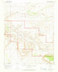
1966 Map of Pueblo Bonito
USGS Topo · Published 1969About this map
Chaco Canyon National Monument occupies the heart of this mid-1960s survey, revealing a landscape defined by ancestral architecture and high-desert hydrology. The map captures the administrative and archaeological layout of the era, centered on the Pueblo Bonito Ranger Station and the Visitors Center. Surrounding these are the massive masonry complexes of Pueblo Bonito Ruins, Chetro Ketl Ruins, and Pueblo Alto Ruins. The terrain is deeply incised by the Chaco Wash and its tributaries, including Mockingbird Canyon and Fajada Wash, which drain the surrounding plateaus of West Mesa and Chacra Mesa. Evidence of modern inhabitation and tourism appears alongside the ancient, with the Chaco Canyon Trading Post, several Landing Strips, and the Gallo Campground providing essential infrastructure for researchers and visitors exploring the remote San Juan and McKinley County borderlands.
Find a feature on this map
38 named features on this map. Tap any name to fly to it.
Don’t see what you’re looking for? This feature index may not catch every label — zoom into the map to look around manually.
Map Details
Editions of this 1966 Pueblo Bonito Map
This is the sole edition of this map. No revisions or reprints were ever made.
Other maps of this area

1883 · Mt. Taylor
USGS Topo · 1:250,000

1886 · Wingate
USGS Topo · 1:250,000

1886 · Mt. Taylor
USGS Topo · 1:250,000

1889 · Largo
USGS Topo · 1:250,000

1889 · Chaco
USGS Topo · 1:250,000

1892 · Wingate
USGS Topo · 1:250,000

1892 · Chaco
USGS Topo · 1:250,000

1892 · Mt. Taylor
USGS Topo · 1:250,000

1895 · Largo
USGS Topo · 1:250,000

1899 · Mt. Taylor
USGS Topo · 1:250,000