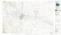
1981 Map of Pueblo
USGS Topo · Published 1981About this map
Pueblo stands as the industrial and transportation hub of this high plains region, situated at the confluence of the Arkansas River and Fountain Creek. By the early 1980s, the urban footprint includes expanding suburbs like Pueblo West and Lombard Village, while the city's role in the national defense and transit infrastructure is underscored by the expansive Pueblo Ordnance Depot and the High Speed Ground Test Center. To the west, the massive Pueblo Reservoir controls the flow of the Arkansas, providing a significant recreational and water-management feature for the county.
Find a feature on this map
94 named features on this map. Tap any name to fly to it.
Don’t see what you’re looking for? This feature index may not catch every label — zoom into the map to look around manually.
Map Details
Editions of this 1981 Pueblo Map
This is the sole edition of this map. No revisions or reprints were ever made.
Other maps of this area

1889 · Canon City
USGS Topo · 1:125,000

1889 · Huerfano Park
USGS Topo · 1:125,000

1889 · Sanborn
USGS Topo · 1:125,000

1891 · Walsenburg
USGS Topo · 1:125,000

1891 · Sanborn
USGS Topo · 1:125,000

1891 · Catlin
USGS Topo · 1:125,000

1891 · Pueblo
USGS Topo · 1:125,000

1891 · Timpas
USGS Topo · 1:125,000

1891 · Nepesta
USGS Topo · 1:125,000

1891 · Apishapa
USGS Topo · 1:125,000