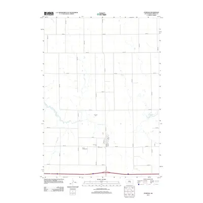
2012 Map of Pukwana
USGS Topo · Published 2012About this map
Pukwana serves as the primary hub of this Brule County landscape, situated just north of the major east-west thoroughfare in the early 21st century. The map reveals a structured grid of rural roads, including 351st Ave and 250th St, which organize the agricultural terrain and link isolated homesteads. Local history and genealogy are anchored by several dedicated burial grounds, such as Norwegian Cem and Saint Anthony Cem, reflecting the cultural heritage of the area's settlers. The presence of the Priebe Landing Strip suggests the importance of private aviation in managing these expansive properties. Natural drainage follows the paths of American Creek and Bad Hand Creek, while Sharpping Lake provides a distinct water feature in the eastern section of the quadrangle.
Find a feature on this map
29 named features on this map. Tap any name to fly to it.
Don’t see what you’re looking for? This feature index may not catch every label — zoom into the map to look around manually.
Map Details
Editions of this 2012 Pukwana Map
This is the sole edition of this map. No revisions or reprints were ever made.
Other maps of this area

1935 · Chamberlain
USGS Topo · 1:62,500

1939 · Chamberlain
USGS Topo · 1:62,500

1940 · Iona
USGS Topo · 1:62,500

1941 · Pukwana
USGS Topo · 1:62,500

1944 · Iona
USGS Topo · 1:62,500

1951 · Pukwana
USGS Topo · 1:62,500

1955 · Mitchell
USGS Topo · 1:250,000

1959 · Mitchell
USGS Topo · 1:250,000

1974 · Red Lake West
USGS Topo · 1:24,000
1974 · Chamberlain
USGS Topo · 1:24,000