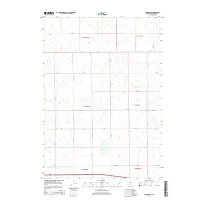
2015 Map of Pukwana SE
USGS Topo · Published 2015About this map
Silver Lake and Mud Lake provide the primary geographic landmarks in this segment of the Great Plains, located south of Pukwana. The landscape is defined by the strict geometry of the Public Land Survey System, with a dense network of section-line roads such as 354th Ave and 359th Ave carving the prairie into square-mile units. These corridors, including 243rd St and 250th St, reflect the late-stage agricultural organization of the region, where transportation was built to serve individual homesteads and farming operations. The terrain shows the subtle drainage patterns of the Missouri Plateau, with these two water bodies acting as natural basins in an otherwise highly structured, road-dependent rural environment. The proximity to the Interstate 90 corridor at the southern edge suggests the evolving connectivity of this Brule County area as it transitioned from local farm-to-market travel to regional highway access.
Find a feature on this map
22 named features on this map. Tap any name to fly to it.
Don’t see what you’re looking for? This feature index may not catch every label — zoom into the map to look around manually.
Map Details
Editions of this 2015 Pukwana SE Map
This is the sole edition of this map. No revisions or reprints were ever made.
Other maps of this area

1941 · Pukwana
USGS Topo · 1:62,500

1941 · Kimball North
USGS Topo · 1:62,500

1951 · Pukwana
USGS Topo · 1:62,500

1951 · Kimball North
USGS Topo · 1:62,500

1955 · Mitchell
USGS Topo · 1:250,000

1959 · Mitchell
USGS Topo · 1:250,000

1979 · Bijou Hills NE
USGS Topo · 1:24,000
1979 · Red Lake East
USGS Topo · 1:24,000

1979 · Kimball South
USGS Topo · 1:24,000
1982 · Kimball North
USGS Topo · 1:25,000