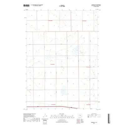
2017 Map of Pukwana SE
USGS Topo · Published 2017About this map
Silver Lake and Mud Lake define the prairie landscape of Brule County in this 2017 survey of the plains. This section of Smith Township is organized by a precise grid of rural section-line roads, such as 244th St and 357th Ave, which partition the agricultural land into traditional rectangular plots. The terrain is marked by numerous small wetlands and depressions typical of the Missouri Plateau region, showing the drainage patterns that feed into these larger named water bodies. While predominantly agricultural, the map illustrates the enduring structure of the Public Land Survey System through its township and range boundaries, including the intersection of t104n r69w and t104n r68w, providing a clear record of land division in south-central South Dakota.
Find a feature on this map
20 named features on this map. Tap any name to fly to it.
Don’t see what you’re looking for? This feature index may not catch every label — zoom into the map to look around manually.
Map Details
Editions of this 2017 Pukwana SE Map
This is the sole edition of this map. No revisions or reprints were ever made.
Other maps of this area

1941 · Pukwana
USGS Topo · 1:62,500

1941 · Kimball North
USGS Topo · 1:62,500

1951 · Pukwana
USGS Topo · 1:62,500

1951 · Kimball North
USGS Topo · 1:62,500

1955 · Mitchell
USGS Topo · 1:250,000

1959 · Mitchell
USGS Topo · 1:250,000

1979 · Bijou Hills NE
USGS Topo · 1:24,000
1979 · Red Lake East
USGS Topo · 1:24,000

1979 · Kimball South
USGS Topo · 1:24,000
1982 · Kimball North
USGS Topo · 1:25,000