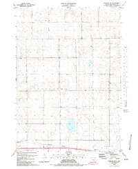
1983 Map of Pukwana SE
USGS Topo · Published 1983About this map
The Old Indian Treaty Boundary slices through the eastern sections of this Brule County landscape, a historical survey line that continues to define property and civil divisions across the prairie. The southern reaches of the map are defined by the Burlington Northern railroad corridor, which skirts the northern edge of the Kimball and Smith townships. This transportation artery was central to the region's agricultural economy, providing a vital link for local grain and livestock to reach larger markets.
Find a feature on this map
14 named features on this map. Tap any name to fly to it.
Don’t see what you’re looking for? This feature index may not catch every label — zoom into the map to look around manually.
Map Details
Editions of this 1983 Pukwana SE Map
This is the sole edition of this map. No revisions or reprints were ever made.
Other maps of this area

1941 · Pukwana
USGS Topo · 1:62,500

1941 · Kimball North
USGS Topo · 1:62,500

1951 · Pukwana
USGS Topo · 1:62,500

1951 · Kimball North
USGS Topo · 1:62,500

1955 · Mitchell
USGS Topo · 1:250,000

1959 · Mitchell
USGS Topo · 1:250,000

1979 · Bijou Hills NE
USGS Topo · 1:24,000
1979 · Red Lake East
USGS Topo · 1:24,000

1979 · Kimball South
USGS Topo · 1:24,000
1982 · Kimball North
USGS Topo · 1:25,000