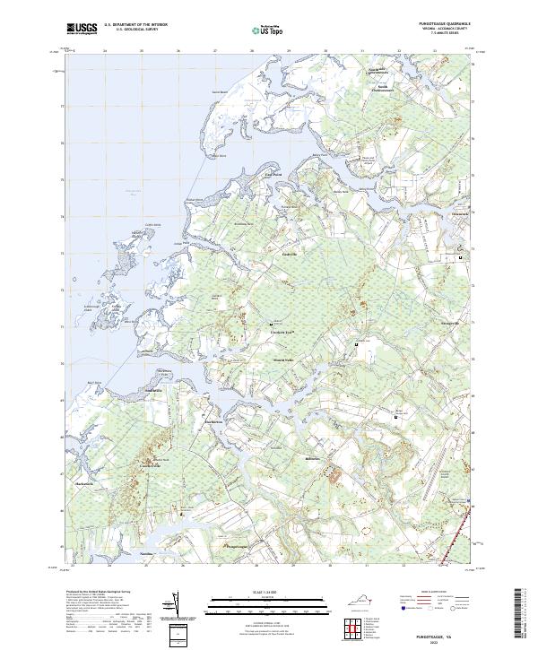
2022 Map of Pungoteague
USGS Topo · Published 2022About this map
The intricate shoreline of Accomack County is defined by countless necks and gouts where the land meets Chesapeake Bay. In this modern survey of the Virginia Eastern Shore, settlements like Pungoteague and Harborton anchor a landscape dominated by tidal marshes and creeks. The map reveals the complex geography of Sluitkill Neck, Finneys Neck, and Bailey Neck, illustrating how historic water-access points continue to shape the regional footprint. Local history and genealogy are well-represented through numerous burial grounds, including the Onancock Cem, Arlington Cem, and the specifically named Ames - Hacks Neck Cem. Inland, the economy is supported by facilities like the Accomack County Airport and the Eastern Shore Community College, while the coastal margins remain a maze of points and islands such as Parkers Island and Scarborough Island.
Find a feature on this map
157 named features on this map. Tap any name to fly to it.
Don’t see what you’re looking for? This feature index may not catch every label — zoom into the map to look around manually.
Map Details
Editions of this 2022 Pungoteague Map
This is the sole edition of this map. No revisions or reprints were ever made.
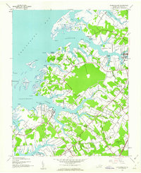
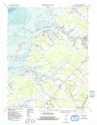
Historical Maps of Pungoteague Through Time
3 maps found