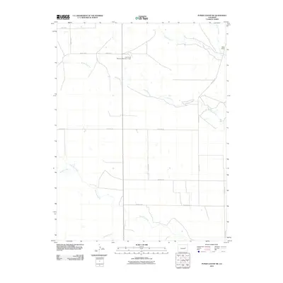
2010 Map of Punkin Center NW
USGS Topo · Published 2010About this map
Middle Rush Creek and its many tributaries define this section of the eastern Colorado plains, where water management and ranching roads create a distinct grid across the landscape. The Fred Pauls Detention Number 1 Dam stands as a significant landmark for water conservation in this arid region, situated just north of the creek's meandering path. The terrain is characterized by broad drainage basins including Apache Creek, South Rush Creek, and Mustang Creek, which converge as they move toward the eastern edge of Elbert County. A rare vertical landmark, Rock Point, rises near the northeastern corner, overlooking the junction of several county routes. This 2010 survey reflects a modern era of rural infrastructure, where named county roads like County Rd-21 and County Rd-34 provide the primary framework for local travel between isolated homesteads and grazing lands.
Find a feature on this map
19 named features on this map. Tap any name to fly to it.
Don’t see what you’re looking for? This feature index may not catch every label — zoom into the map to look around manually.
Map Details
Editions of this 2010 Punkin Center NW Map
This is the sole edition of this map. No revisions or reprints were ever made.
Other maps of this area

1889 · Sanborn
USGS Topo · 1:125,000

1891 · Sanborn
USGS Topo · 1:125,000

1891 · Limon
USGS Topo · 1:125,000

1892 · Limon
USGS Topo · 1:125,000

1893 · Sanborn
USGS Topo · 1:125,000

1954 · Limon
USGS Topo · 1:250,000

1954 · Lamar
USGS Topo · 1:250,000

1957 · Limon
USGS Topo · 1:250,000

1958 · Limon
USGS Topo · 1:250,000

1958 · Lamar
USGS Topo · 1:250,000