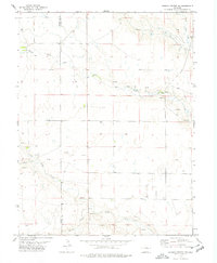
1978 Map of Punkin Center NW
USGS Topo · Published 1978About this map
The high plains of eastern Colorado are defined by a complex network of intermittent waterways on this 1970s topographic study. The drainage patterns of Middle Rush Creek, North Rush Creek, and South Rush Creek dominate the landscape, illustrating the critical importance of water management in this arid region. The boundary between Elbert Co and Lincoln Co bisects the terrain, which is marked by scattered Spring and Springs locations that historically served as vital resources for local ranching operations. Human activity is evidenced by several Gravel Pit excavations and a grid of rural infrastructure. The presence of Apache Creek and Mustang Creek further highlights the natural hydrology that shaped settlement and land use across these eastern counties during the late twentieth century.
Find a feature on this map
10 named features on this map. Tap any name to fly to it.
Don’t see what you’re looking for? This feature index may not catch every label — zoom into the map to look around manually.
Map Details
Editions of this 1978 Punkin Center NW Map
This is the sole edition of this map. No revisions or reprints were ever made.
Other maps of this area

1889 · Sanborn
USGS Topo · 1:125,000

1891 · Sanborn
USGS Topo · 1:125,000

1891 · Limon
USGS Topo · 1:125,000

1892 · Limon
USGS Topo · 1:125,000

1893 · Sanborn
USGS Topo · 1:125,000

1954 · Limon
USGS Topo · 1:250,000

1954 · Lamar
USGS Topo · 1:250,000

1957 · Limon
USGS Topo · 1:250,000

1958 · Limon
USGS Topo · 1:250,000

1958 · Lamar
USGS Topo · 1:250,000