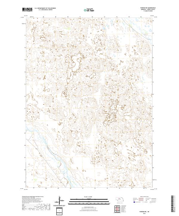
2021 Map of Purdum NE
USGS Topo · Published 2021About this map
The North Loup River flows through the southwestern corner of this landscape in Cherry County, carving a distinct valley through the Nebraska Sandhills. This 2021 study illustrates a drainage pattern characteristic of the region, where the river and smaller tributaries like Calf Cr and Goose Cr weave through a terrain defined by subtle elevation changes rather than dense development. The lack of named settlements or major roads emphasizes the preservation of the open range and the persistent rural character of the Nebraska interior. Historical property boundaries, including sections within t26n r26w and t25n r25w, provide a framework for understanding the large-scale ranching and land use that have defined this part of the state for generations.
Find a feature on this map
7 named features on this map. Tap any name to fly to it.
Don’t see what you’re looking for? This feature index may not catch every label — zoom into the map to look around manually.
Map Details
Editions of this 2021 Purdum NE Map
This is the sole edition of this map. No revisions or reprints were ever made.
Other maps of this area

1949 · Purdum
USGS Topo · 1:62,500

1949 · Koshopah
USGS Topo · 1:62,500

1949 · Long Lake
USGS Topo · 1:62,500

1951 · Long Lake
USGS Topo · 1:62,500

1951 · Purdum
USGS Topo · 1:62,500

1951 · Moon Lake
USGS Topo · 1:62,500

1951 · Koshopah
USGS Topo · 1:62,500

1957 · Valentine
USGS Topo · 1:250,000

1959 · Valentine
USGS Topo · 1:250,000
1985 · Long Lake SE
USGS Topo · 1:24,000