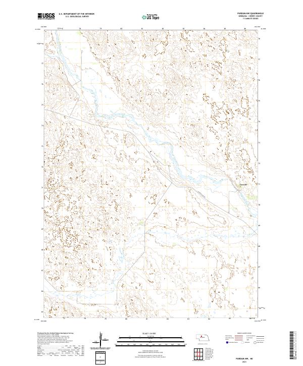
2021 Map of Purdum NW
USGS Topo · Published 2021About this map
The North Loup River winds through the sandhills of northern Nebraska, carving a distinct valley through the Nebraska Sandhills. This 2021 landscape is defined by its sparse human footprint, centered primarily around the small settlement of Cascade in the eastern portion of the quadrangle. The river’s braided path is accompanied by W North Loup Rd, which provides the primary transit route through this remote section of Cherry County. Further south, the terrain remains largely dominated by the characteristic dune formations and drainage patterns of Calf Cr. The map reveals a ranching landscape where development is concentrated near water sources and along the valley floor, maintaining the traditional land use patterns of the Great Plains.
Find a feature on this map
8 named features on this map. Tap any name to fly to it.
Don’t see what you’re looking for? This feature index may not catch every label — zoom into the map to look around manually.
Map Details
Editions of this 2021 Purdum NW Map
This is the sole edition of this map. No revisions or reprints were ever made.
Other maps of this area

1948 · Seneca 4
USGS Topo · 1:62,500

1949 · Seneca 4
USGS Topo · 1:62,500

1949 · Purdum
USGS Topo · 1:62,500

1949 · Long Lake
USGS Topo · 1:62,500

1951 · Long Lake
USGS Topo · 1:62,500

1951 · Purdum
USGS Topo · 1:62,500

1951 · Brownlee
USGS Topo · 1:62,500

1957 · Valentine
USGS Topo · 1:250,000

1959 · Valentine
USGS Topo · 1:250,000
1985 · Long Lake SE
USGS Topo · 1:24,000