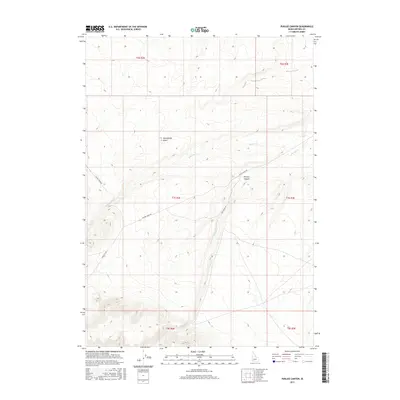
2017 Map of Purjue Canyon
USGS Topo · Published 2017About this map
Purjue Canyon and the surrounding drainage basins of Owyhee County are defined by a complex network of seasonal waterways and primitive access routes. This 2017 survey shows a landscape managed through the Public Land Survey System, marked by township boundaries like t7s r2e and t7s r3e. The topography is shaped by the descent of Poison Cr and Shoofly Cr as they cut through the high desert plateau. Human presence is primarily indicated by a sparse network of rangeland roads, including Poison Creek Rd and Castle Creek Rd, which provide essential access for ranching and resource management. Notable geographic landmarks such as Twentymile Gulch demonstrate the erosional patterns of the Owyhee Front, where small tributaries have carved distinct features into the volcanic and sedimentary layers over millennia.
Find a feature on this map
14 named features on this map. Tap any name to fly to it.
Don’t see what you’re looking for? This feature index may not catch every label — zoom into the map to look around manually.
Map Details
Editions of this 2017 Purjue Canyon Map
This is the sole edition of this map. No revisions or reprints were ever made.
Other maps of this area

1947 · Grand View
USGS Topo · 1:62,500

1947 · Grand View
USGS Topo · 1:24,000

1947 · Chalk Hills
USGS Topo · 1:24,000

1947 · Vinson Wash
USGS Topo · 1:24,000

1947 · Perjue Canyon
USGS Topo · 1:24,000

1948 · Perjue Canyon
USGS Topo · 1:24,000

1948 · Vinson Wash
USGS Topo · 1:24,000
1948 · Grand View
USGS Topo · 1:24,000
1948 · Chalk Hills
USGS Topo · 1:24,000

1955 · Jordan Valley
USGS Topo · 1:250,000