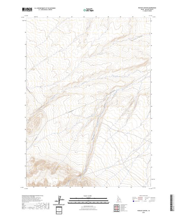
2023 Map of Purjue Canyon
USGS Topo · Published 2023About this map
Little Jacks Creek Wilderness dominates the southern reaches of this landscape in Owyhee County, marking a transition into protected public lands. The drainage network is the defining characteristic of this area, with Purjue Canyon carving through the center of the sheet. Seasonal watercourses such as Shoofly Creek, Poison Creek, and Twentymile Gulch define the topography, illustrating the erosive power of water in this high desert environment. While largely uninhabited, the presence of Poison Creek Rd and Mud Flat Rd indicates the primary routes for ranching or recreational access. The map reveals how local infrastructure like Paul Black Ln and Castle Creek Rd skirts the edges of the more complex terrain, following the natural contours of the land around the deeper canyons.
Find a feature on this map
15 named features on this map. Tap any name to fly to it.
Don’t see what you’re looking for? This feature index may not catch every label — zoom into the map to look around manually.
Map Details
Editions of this 2023 Purjue Canyon Map
This is the sole edition of this map. No revisions or reprints were ever made.
Other maps of this area

1947 · Grand View
USGS Topo · 1:62,500

1947 · Grand View
USGS Topo · 1:24,000

1947 · Chalk Hills
USGS Topo · 1:24,000

1947 · Vinson Wash
USGS Topo · 1:24,000

1947 · Perjue Canyon
USGS Topo · 1:24,000

1948 · Perjue Canyon
USGS Topo · 1:24,000

1948 · Vinson Wash
USGS Topo · 1:24,000
1948 · Grand View
USGS Topo · 1:24,000
1948 · Chalk Hills
USGS Topo · 1:24,000

1955 · Jordan Valley
USGS Topo · 1:250,000