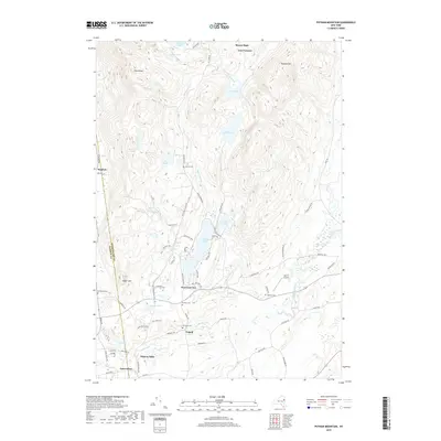
2019 Map of Putnam Mountain
USGS Topo · Published 2019About this map
Adirondack Park land meets the historic rural settlements of northern New York in this detailed 2019 survey. The landscape is defined by the sharp transition from the heights of Putnam Mtn and Pilot Knob down to the agricultural and residential pockets of West Fort Ann and Tripoli. Water dominates the central terrain, with the long reach of Lake Nebo and Hadlock Pond following the valley floor, while smaller bodies like Lake Pond and The Three Ponds sit perched at higher elevations.
Find a feature on this map
76 named features on this map. Tap any name to fly to it.
Don’t see what you’re looking for? This feature index may not catch every label — zoom into the map to look around manually.
Map Details
Editions of this 2019 Putnam Mountain Map
This is the sole edition of this map. No revisions or reprints were ever made.
Other maps of this area

1893 · Fort Ann
USGS Topo · 1:62,500

1893 · Whitehall
USGS Topo · 1:62,500

1895 · Whitehall
USGS Topo · 1:62,500

1895 · Fort Ann
USGS Topo · 1:62,500

1895 · Glens Falls
USGS Topo · 1:62,500

1897 · Bolton
USGS Topo · 1:62,500

1897 · Glens Falls
USGS Topo · 1:62,500

1898 · Whitehall
USGS Topo · 1:62,500

1898 · Fort Ann
USGS Topo · 1:62,500

1900 · Bolton
USGS Topo · 1:62,500