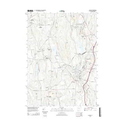
2015 Map of Putnam
USGS Topo · Published 2015About this map
The Quinebaug River and French River corridors define the landscape of northeastern Connecticut in this 2015 study, anchoring the industrial and civic development of Putnam and North Grosvenor Dale. The map reveals a dense network of early settlements and rural infrastructure, from the historic clusters at Woodstock and Pomfret to the water-managed features like the Cargill Falls Reservoir and the expansive W Thompson Lake. Genealogists will find a wealth of burial sites including Swiss Cem, Quasset Cem, and the Carpenter-Dresser Cem. The inclusion of the Woodstock Airport and Roseland Park highlights the evolution of the region into a mix of small-town residential life, light industry, and preserved open space, maintaining the character of these historic mill-and-farm communities.
Find a feature on this map
166 named features on this map. Tap any name to fly to it.
Don’t see what you’re looking for? This feature index may not catch every label — zoom into the map to look around manually.
Map Details
Editions of this 2015 Putnam Map
This is the sole edition of this map. No revisions or reprints were ever made.
Other maps of this area

1887 · Brookfield
USGS Topo · 1:62,500

1889 · Webster
USGS Topo · 1:62,500

1889 · Putnam
USGS Topo · 1:62,500

1890 · Brookfield
USGS Topo · 1:62,500

1892 · Woodstock
USGS Topo · 1:62,500

1892 · Webster
USGS Topo · 1:62,500

1893 · Putnam
USGS Topo · 1:62,500

1893 · Brookfield
USGS Topo · 1:62,500

1908 · Quinsigamond
USGS Topo · 1:125,000

1908 · Ware
USGS Topo · 1:125,000