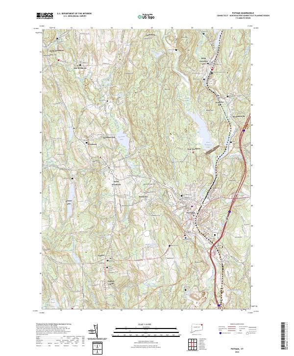
2024 Map of Putnam
USGS Topo · Published 2024About this map
Putnam serves as the focal point of this northeastern Connecticut survey, where the Quinebaug River winds through a landscape defined by historic mill-era settlements and agricultural heritage. The village of Harrisville and the town centers of Woodstock and Pomfret are mapped alongside numerous ancestral sites, including the Old Killingly Burial Ground and Woodstock Hill Cem. The region's transport evolution is visible through the alignment of the Airline Trl, following the path of former rail infrastructure, and the presence of the Woodstock Airport. Significant water bodies like West Thompson Lake and Roseland Lake punctuate the terrain, which rises toward landmarks such as Bull Hill and Hospital Hill. This record provides a detailed look at the 21st-century configuration of these long-established New England communities.
Find a feature on this map
93 named features on this map. Tap any name to fly to it.
Don’t see what you’re looking for? This feature index may not catch every label — zoom into the map to look around manually.
Map Details
Editions of this 2024 Putnam Map
This is the sole edition of this map. No revisions or reprints were ever made.
Other maps of this area

1887 · Brookfield
USGS Topo · 1:62,500

1889 · Webster
USGS Topo · 1:62,500

1889 · Putnam
USGS Topo · 1:62,500

1890 · Brookfield
USGS Topo · 1:62,500

1892 · Woodstock
USGS Topo · 1:62,500

1892 · Webster
USGS Topo · 1:62,500

1893 · Putnam
USGS Topo · 1:62,500

1893 · Brookfield
USGS Topo · 1:62,500

1908 · Quinsigamond
USGS Topo · 1:125,000

1908 · Ware
USGS Topo · 1:125,000