
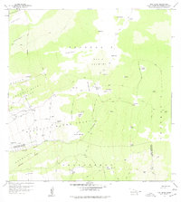
1959 Map of Puu Lehua
USGS Topo · Published 1960About this map
Puu Lehua Ranch and the surrounding high-elevation grazing lands of the North and South Kona districts are meticulously documented in this 1959 survey. The landscape is defined by its volcanic activity, notably the numerous kipuka — islands of older vegetation surrounded by more recent lava flows — such as Kipuka Paluli, Kipuka Major, and Kipuka Mamani. These natural features dictated the placement of early ranching infrastructure, including several Rain Shed structures and an extensive Fence Line network essential for managing livestock in the demanding Devil Country.
Find a feature on this map
53 named features on this map. Tap any name to fly to it.
Don’t see what you’re looking for? This feature index may not catch every label — zoom into the map to look around manually.
Map Details
Editions of this 1959 Puu Lehua Map
2 editions found
Other maps of this area

1927 · Kaohe
USGS Topo · 1:62,500

1928 · Kailua
USGS Topo · 1:62,500

1928 · Mauna Loa
USGS Topo · 1:62,500

1930 · Kaohe
USGS Topo · 1:62,500

1954 · Hawaii South
USGS Topo · 1:250,000

1954 · Hawaii North
USGS Topo · 1:250,000

1956 · Puu O Uo
USGS Topo · 1:24,000

1956 · Naohueleelua
USGS Topo · 1:24,000

1959 · Hawaii South
USGS Topo · 1:250,000

1959 · Hawaii North
USGS Topo · 1:250,000