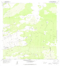
1959 Map of Puu Lehua
USGS Topo · Published 1977About this map
The high slopes of the North and South Kona Districts are defined here by complex volcanic terrain and a sparse network of ranching infrastructure. Devil Country occupies a significant portion of the central landscape, characterized by numerous volcanic features like Kipuka Paluli, Lupea Kipuka, and Mizotas Kipuka. Human presence is evidenced by isolated outposts such as Puu Lehua Ranch, the Kahelepo House, and the namesake Puu Lehua cinder cone. This 1959 survey reveals how the land was managed through an extensive system of fence lines, jeep trails, and strategically placed rain sheds for water collection. The transition between the North Kona District and South Kona District is clearly delineated, crossing through the Lehuula Mauka Tract and the Hokukano Mauka Tract, illustrating the division of these upland forest and grazing lands.
Find a feature on this map
53 named features on this map. Tap any name to fly to it.
Don’t see what you’re looking for? This feature index may not catch every label — zoom into the map to look around manually.
Map Details
Editions of this 1959 Puu Lehua Map
2 editions found

Other maps of this area

1927 · Kaohe
USGS Topo · 1:62,500

1928 · Kailua
USGS Topo · 1:62,500

1928 · Mauna Loa
USGS Topo · 1:62,500

1930 · Kaohe
USGS Topo · 1:62,500

1954 · Hawaii South
USGS Topo · 1:250,000

1954 · Hawaii North
USGS Topo · 1:250,000

1956 · Puu O Uo
USGS Topo · 1:24,000

1956 · Naohueleelua
USGS Topo · 1:24,000

1959 · Hawaii South
USGS Topo · 1:250,000

1959 · Hawaii North
USGS Topo · 1:250,000