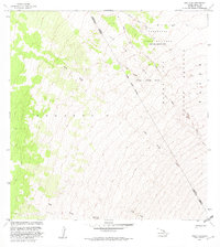
1981 Map of Puu O Uo
USGS Topo · Published 1982About this map
The Lava Flow of 1859 dominates this landscape on the slopes of Hawaii’s central highlands, cutting a wide diagonal path across the Mauna Loa Forest Reserve. The map illustrates the complex volcanic topography of the Kea Uhou 2 region, where the historical eruption left distinct channels and lobes across the terrain. A significant portion of the northern area is designated as the Pohakuloa Training Area (Military Reservation), reflecting the long-standing military use of these high-elevation lava fields for tactical maneuvers. Along the upper margins, the Bobcat Trail and sections of the Kona Highway provide the primary human-made infrastructure in an otherwise desolate environment. This 1981 revision records the meeting of the Hamakua District and North Kona District lines as they cross the cinder cone of Puu o Uo, also known as Sulphur Cone.
Find a feature on this map
12 named features on this map. Tap any name to fly to it.
Don’t see what you’re looking for? This feature index may not catch every label — zoom into the map to look around manually.
Map Details
Editions of this 1981 Puu O Uo Map
This is the sole edition of this map. No revisions or reprints were ever made.
Other maps of this area

1927 · Kaohe
USGS Topo · 1:62,500

1928 · Kailua
USGS Topo · 1:62,500

1928 · Mauna Loa
USGS Topo · 1:62,500

1930 · Kaohe
USGS Topo · 1:62,500

1954 · Hawaii South
USGS Topo · 1:250,000

1954 · Hawaii North
USGS Topo · 1:250,000

1956 · Puu Koli
USGS Topo · 1:24,000

1956 · Puu O Uo
USGS Topo · 1:24,000
1956 · Kokoolau
USGS Topo · 1:24,000

1956 · Naohueleelua
USGS Topo · 1:24,000