
1956 Map of Puu Koli
USGS Topo · Published 1957About this map
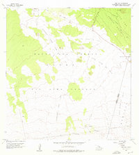
Keamuku Lava Flow and several historic volcanic events define the geological character of this high-elevation landscape on the Island of Hawaii. The sheet provides a clear visualization of the Lava Flow of 1843 and the more recent Lava Flow of 1935 as they descend through the Mauna Kea Forest Reserve. This mid-century survey captures the rugged interior where the Kaohe Game Reserve meets the volcanic slopes, centered around the Humuula Saddle. Civil infrastructure is represented by the Saddle Road and the Hilo Kona Road, which provided vital transit across the island's interior. Small outposts and surveying points like Manus, Puuahi, and the summit of Puu Koli are documented, along with natural features including Lava Tubes and a prominent Crack, illustrating the raw volcanic terrain before further modern development.
Find a feature on this map
17 named features on this map. Tap any name to fly to it.
Don’t see what you’re looking for? This feature index may not catch every label — zoom into the map to look around manually.
Map Details
Editions of this 1956 Puu Koli Map
2 editions found
Other maps of this area

1927 · Kaohe
USGS Topo · 1:62,500

1930 · Humuula
USGS Topo · 1:62,500

1930 · Kaohe
USGS Topo · 1:62,500

1954 · Hawaii North
USGS Topo · 1:250,000

1956 · Puu Oo
USGS Topo · 1:24,000
1956 · Puu Ulaula
USGS Topo · 1:24,000

1956 · Keamuku
USGS Topo · 1:24,000

1956 · Puu O Uo
USGS Topo · 1:24,000
1956 · Ahumoa
USGS Topo · 1:24,000
1956 · Kokoolau
USGS Topo · 1:24,000