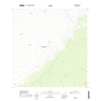
2017 Map of Puukinikini
USGS Topo · Published 2017About this map
Hawai'i Volcanoes National Park dominates this terrain, revealing a landscape defined by sequential volcanic activity on the Island of Hawai'i. The map documents the specific paths of the Lava Flow of 1949, the Lava Flow of 1926, and the Lava Flow of 1950, which descend from the higher elevations toward the coast. These historical flows provide a clear record of the island's geological transformation over the mid-20th century, showing how the molten rock reshaped the land around Pu'ukinikini.
Find a feature on this map
20 named features on this map. Tap any name to fly to it.
Don’t see what you’re looking for? This feature index may not catch every label — zoom into the map to look around manually.
Map Details
Editions of this 2017 Puukinikini Map
This is the sole edition of this map. No revisions or reprints were ever made.
Other maps of this area

1921 · Kilauea
USGS Topo · 1:62,500

1923 · Pahala
USGS Topo · 1:62,500

1924 · Kilauea
USGS Topo · 1:62,500

1924 · Honuapo
USGS Topo · 1:62,500

1928 · Mauna Loa
USGS Topo · 1:62,500

1954 · Hawaii South
USGS Topo · 1:250,000

1959 · Hawaii South
USGS Topo · 1:250,000

1961 · Hawaii South
USGS Topo · 1:250,000

1962 · Hawaii South
USGS Topo · 1:250,000
1966 · Mauna Loa
USGS Topo · 1:24,000