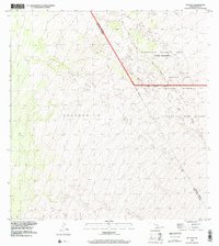
1993 Map of Puuoo
USGS Topo · Published 2000About this map
The Lava Flow of 1859 dominates this high-elevation landscape on the Island of Hawaii, illustrating the powerful volcanic processes that continue to shape the district boundaries. This 1993 revision, based on imagery and survey control from the late 20th century, captures a rugged expanse where the Pohakuloa Training Area meets vast conservation and hunting lands. The map details the intersection of the Mauna Loa Forest Reserve, Ka'ohe Game Reserve, and Mauna Loa Game Reserve. Significant administrative divisions are also recorded, showing the line where the Hamakua and North Kona Districts meet amidst the ancient and more recent Lava Flow deposits. Access to this remote volcanic terrain is primarily through the Kona Highway, which skirts the northern edge of the volcanic features.
Find a feature on this map
9 named features on this map. Tap any name to fly to it.
Don’t see what you’re looking for? This feature index may not catch every label — zoom into the map to look around manually.
Map Details
Editions of this 1993 Puuoo Map
This is the sole edition of this map. No revisions or reprints were ever made.
Other maps of this area

1924 · Honuapo
USGS Topo · 1:62,500

1928 · Mauna Loa
USGS Topo · 1:62,500

1928 · Hoopuloa
USGS Topo · 1:62,500

1954 · Hawaii South
USGS Topo · 1:250,000

1959 · Hawaii South
USGS Topo · 1:250,000

1959 · Honaunau
USGS Topo · 1:24,000
1960 · Kaunene
USGS Topo · 1:24,000

1961 · Hawaii South
USGS Topo · 1:250,000

1962 · Hawaii South
USGS Topo · 1:250,000

1962 · Milolii
USGS Topo · 1:24,000