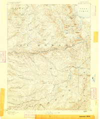
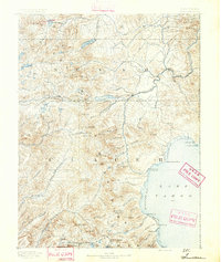
1891 Map of Pyramid Peak
USGS Topo · Published 1891About this map
The High Sierra landscape around Lake Tahoe is documented here during the late nineteenth century, a period when the region was defined by early resort outposts and rugged mountain transit. The southwestern shores of the lake are clearly marked with historic stops such as Tallac, Yanks, and the picturesque Emerald Bay. Inland, the terrain is dotted with early settler family names and remote stations like Uncle Toms Cabin and Phillips, indicating the early human footprint before the era of modern development.
Find a feature on this map
136 named features on this map. Tap any name to fly to it.
Don’t see what you’re looking for? This feature index may not catch every label — zoom into the map to look around manually.
Map Details
Editions of this 1891 Pyramid Peak Map
This is the sole edition of this map. No revisions or reprints were ever made.
Other maps of this area

1889 · Jackson
USGS Topo · 1:125,000

1889 · Pyramid Peak
USGS Topo · 1:125,000
1889 · Markleeville
USGS Topo · 1:125,000
1891 · Carson
USGS Topo · 1:125,000
1891 · Markleeville
USGS Topo · 1:125,000

1891 · Colfax
USGS Topo · 1:125,000
1891 · Truckee
USGS Topo · 1:125,000

1891 · Big Trees
USGS Topo · 1:125,000

1891 · Placerville
USGS Topo · 1:125,000

1892 · Jackson
USGS Topo · 1:125,000