
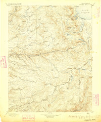
1895 Map of Pyramid Peak
USGS Topo · Published 1895About this map
Lake Tahoe borders the northeastern corner of this Sierra Nevada landscape, where early resort culture is already taking shape at Glen Alpine Springs and near Fallen Leaf Lake. The terrain is defined by the high granite peaks of the Desolation Wilderness area, including Pyramid Peak and Dicks Peak, dropping down to the South Fork American River. Evidence of the region’s 19th-century resource and transport economy is visible in the network of ditch camps, such as Ditch Camp 10, and isolated mountain outposts like Uncle Toms Cabin and Slippery Ford. To the south, the map traces the headwaters of the Mokelumne River and the North Fork Cosumnes River, where small settlements like Dogtown and Phillips mark the thin human footprint in this high-altitude environment.
Find a feature on this map
159 named features on this map. Tap any name to fly to it.
Don’t see what you’re looking for? This feature index may not catch every label — zoom into the map to look around manually.
Map Details
Editions of this 1895 Pyramid Peak Map
2 editions found
Other maps of this area

1889 · Jackson
USGS Topo · 1:125,000

1889 · Pyramid Peak
USGS Topo · 1:125,000

1889 · Markleeville
USGS Topo · 1:125,000

1891 · Carson
USGS Topo · 1:125,000

1891 · Markleeville
USGS Topo · 1:125,000

1891 · Colfax
USGS Topo · 1:125,000

1891 · Truckee
USGS Topo · 1:125,000

1891 · Big Trees
USGS Topo · 1:125,000

1891 · Placerville
USGS Topo · 1:125,000

1891 · Pyramid Peak
USGS Topo · 1:125,000