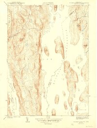
1944 Map of Quabbin Reservoir
USGS Topo · Published 1944About this map
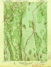
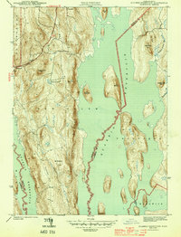
The Quabbin Reservoir defines this landscape in the early 1940s, shown shortly after the flooding that fundamentally reshaped the borders of Franklin and Worcester counties. The map documents the remnants of high-ground settlements and hills that became islands or peninsulas within the vast water project. To the west, North Prescott and Cooleyville appear as high-elevation outposts above the rising waterline. The terrain is marked by prominent peaks such as Packard Mtn, Bials Hill, and Mt Pleasant, while Soapstone Hill and Rattlesnake Hill rise sharply from the reservoir's eastern edges. This topography reveals the significant transition from the historic river valleys to the artificial shoreline, capturing the area in its first years as a completed public works project.
Find a feature on this map
26 named features on this map. Tap any name to fly to it.
Don’t see what you’re looking for? This feature index may not catch every label — zoom into the map to look around manually.
Map Details
Editions of this 1944 Quabbin Reservoir Map
3 editions found
Other maps of this area

1887 · Warwick
USGS Topo · 1:62,500

1887 · Belchertown
USGS Topo · 1:62,500

1887 · Winchendon
USGS Topo · 1:62,500

1887 · Barre
USGS Topo · 1:62,500

1889 · Barre
USGS Topo · 1:62,500

1889 · Warwick
USGS Topo · 1:62,500

1890 · Belchertown
USGS Topo · 1:62,500

1890 · Winchendon
USGS Topo · 1:62,500

1893 · Belchertown
USGS Topo · 1:62,500

1894 · Winchendon
USGS Topo · 1:62,500