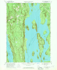
1967 Map of Quabbin Reservoir
USGS Topo · Published 1969About this map
Quabbin Reservoir dominates this mid-century landscape, its sprawling waters surrounding numerous islands that were once high ground in the Swift River Valley. The map captures the area after the valley's inundation, showing the dramatic topography of Mount Zion, Mount L, and Curtis Hill rising as islands from the reservoir. On the western shore, the remnants of rural life remain visible in the road networks around North Prescott and Cooleyville. Genealogists may find interest in the isolated Mtn View Cem or the legacy of smaller settlements like Putnam and Gearing Sta. The eastern edge is defined by the Federated Womens Club State Forest and the steep terrain leading to The Gorge, illustrating the transition from managed forest lands to the protected watershed that secures the region's water supply.
Find a feature on this map
41 named features on this map. Tap any name to fly to it.
Don’t see what you’re looking for? This feature index may not catch every label — zoom into the map to look around manually.
Map Details
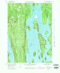
Editions of this 1967 Quabbin Reservoir Map
2 editions found
Other maps of this area

1887 · Warwick
USGS Topo · 1:62,500

1887 · Belchertown
USGS Topo · 1:62,500

1887 · Winchendon
USGS Topo · 1:62,500

1887 · Barre
USGS Topo · 1:62,500

1889 · Barre
USGS Topo · 1:62,500

1889 · Warwick
USGS Topo · 1:62,500

1890 · Belchertown
USGS Topo · 1:62,500

1890 · Winchendon
USGS Topo · 1:62,500

1893 · Belchertown
USGS Topo · 1:62,500

1894 · Winchendon
USGS Topo · 1:62,500